-
AGRICULTURAL MACHINERY
- USED MACHINERY
- SERVICE
- PARTS


- Home
- Precision agriculture


The soil analysis system - SoilXplorer
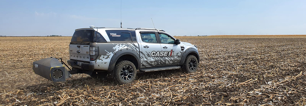
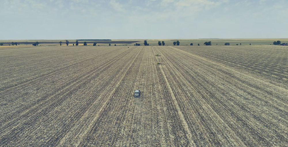
Titan Machinery Romania is ready to support its agricultural partners with state-of-the-art technology on the international market. We are talking about the SoilXplorer scanning sensor which has the role of analysing and highlighting the physical and biological typology of the exploited soil. The scanning is done with the help of a land Pick-Up that covers the farmers’ agricultural surfaces. The result of the test is represented by three types of analysed elements: the degree of soil compaction, the texture (which can then be used for spreading fertilizer or seeding, both at a variable rate) and the degree of soil moisture.
What is it about?
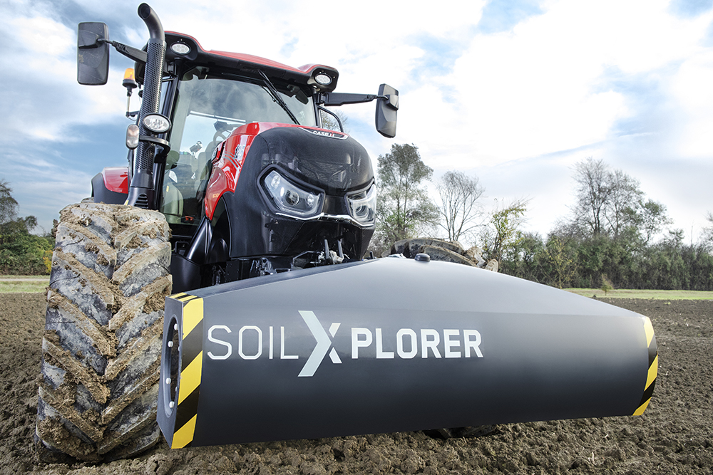
A new worldwide smart solution is ready to come to your attention and use. This is the soil scanning sensor, called SoilXplorer. Being an autonomous soil conductivity measurement system, the new SoilXplorer sensor collects all the data you need to optimize soil management, such as the degree of compaction, texture and water content. Given that there is no direct contact with the soil, the SoilXplorer sensor scans even in the presence of stagnant water or high vegetation. Moreover, this sensor can control the working depth of the processing operations in real time and adjust the seeding rate.
How does it work?
The SoilXplorer sensor emits an electromagnetic signal into the ground while four coils measure the conductivity of the soil at four different depths. When the sensor is located 40 cm above the ground, these depths are: 0–25 cm, 15–60 cm, 55–95 cm and 85–115 cm. According to an agronomic model, it computes soil compaction, soil texture and water content. Associated with a GPS receiver, the system can also record and map the heterogeneity for each of the four depths. Of course, electromagnetic signals do not influence vegetation and soil life.
The advantages for farmers are as follows:
» Independent measurement of soil conductivity;
» A better understanding of soil and soil areas;
» Energy saving (fuel);
» Recognition of soil variety;
» The seeding rate is optimized according to the real conditions of the soil;
» A base for decision-making regarding the agricultural operations on the field (fertilization, soil processing and seeding, planting);
» Creating variable application maps;
» Stimulating sustainability and improving soil structure;
» Improved water management;
» The adjustment of compaction using different processing strategies (stimulation of root system and of earthworms’ activity);
» Efficient land processing operations.
Types of available maps:
»» Water content (rWTC)
»» Hardpan depth (D2I)
»» Soil areas
»» Applications for soil processing
»» Hardpan depth (D2I)
»» Soil areas
»» Applications for soil processing
Titan Machinery România este pregătită să acorde sprijin partenerilor săi agricoli cu o tehnologie de ultimă oră pe piața internațională. Este vorba de senzorul de scanare SoilXplorer care are rolul de a analiza și a scoate în evidentă tipologia fizică și biologică a solului exploatat. Scanarea se efectuează cu ajutorul unui Pick-Up de teren care parcurge suprafețele agricole ale fermierilor. Rezultatul testării este reprezentat de trei tipuri de elemente analizate: gradul de compactare al solului, textura (care poate folosi apoi la împrăștierea îngrășămintelor sau la semănat, ambele cu rată variabilă) și gradul de umiditate din sol.
Despre ce este vorba?
O nouă soluție inteligentă la nivel internațional este pregătită să intre în atenția și folosința dumneavoastră. Este vorba despre senzorul de scanare a solului, denumit SoilXplorer. Fiind un sistem autonom de măsurare a conductivităţii solului, noul senzor SoilXplorer colectează toate datele de care aveţi nevoie pentru a optimiza gestionarea solului, precum gradul de compactare, textura și conţinutul de apă. Deoarece nu are contact direct cu solul, senzorul SoilXplorer scanează chiar dacă există apă stagnantă sau vegetație înaltă. Mai mult, acest senzor poate controla în timp real adâncimea de lucru a operaţiilor de prelucrare și poate regla rata de însămânțare.
O nouă soluție inteligentă la nivel internațional este pregătită să intre în atenția și folosința dumneavoastră. Este vorba despre senzorul de scanare a solului, denumit SoilXplorer. Fiind un sistem autonom de măsurare a conductivităţii solului, noul senzor SoilXplorer colectează toate datele de care aveţi nevoie pentru a optimiza gestionarea solului, precum gradul de compactare, textura și conţinutul de apă. Deoarece nu are contact direct cu solul, senzorul SoilXplorer scanează chiar dacă există apă stagnantă sau vegetație înaltă. Mai mult, acest senzor poate controla în timp real adâncimea de lucru a operaţiilor de prelucrare și poate regla rata de însămânțare.
Cum funcţionează?
Senzorul SoilXplorer emite un semnal electromagnetic în sol în timp ce patru bobine măsoară conductivitatea solului la patru adâncimi diferite. Atunci când senzorul este localizat la 40 cm deasupra solului, aceste adâncimi sunt: 0–25 cm, 15– 60 cm, 55–95 cm și 85–115 cm. În funcţie de un model agronomic calculează compactarea solului, textura solului si conţinutul de apă. Asociat cu un receptor GPS, sistemul poate înregistra și mapa eterogenitatea pentru fiecare din cele patru adâncimi. Desigur, semnalele electromagnetice nu influenţează vegetaţia și viaţa din sol.
Avantajele pentru fermieri sunt următoarele:
» Măsurarea independentă a conductivităţii solului;
» O înţelegere mai bună a solului și a zonelor solului;
» Economisirea de energie (combustibil);
» Recunoașterea varietății solului;
» Rata de însămânţare optimizată în funcţie de condiţiile reale ale solului;
» Bază decizională pentru operaţiile agricole pe câmp (fertilizare, prelucrare a pământului și însămânţare, plantare);
» Crearea unor hărţi de aplicare variabilă;
» Stimularea sustenabilităţii și îmbunătăţirea structurii solului;
» Gestionare îmbunătăţită a apei;
» Soluţionarea compactării folosind diferite strategii de prelucrare (stimularea sistemului de rădăcini și activităţii viermilor din pământ);
» Operaţii eficiente de prelucrare a terenului.
Tipuri de hărţi disponibile:
»» Conţinut de apă (rWTC)
»» Adâncime harpan (D2I)
»» Zone ale solului
»» Aplicaţii pentru prelucrarea solului
»» Adâncime harpan (D2I)
»» Zone ale solului
»» Aplicaţii pentru prelucrarea solului
INDUSTRIES
SC Titan Machinery Romania
SRL